skip to main | skip to sidebar

Ordovician-Silurian

The Bruce Trail + Niagara Escarpment : An UNESCO World Biosphere Reserve

22.2.11

redirect

http://www.panoramio.com/user/784799
Posted by dataCLOUD at 2/22/2011 No comments:
Labels: THE BRUCE TRAIL

24.8.10

first light

Posted by dataCLOUD at 8/24/2010 No comments:
Labels: georgian bay

michiganders side trail


Posted by dataCLOUD at 8/24/2010 No comments:
Labels: michiganders side trail ... bruce trail

'the lookout' on the michiganders side trail

Posted by dataCLOUD at 8/24/2010 No comments:
Labels: 'the lookout' on the michiganders side trail

dyers bay, ontario

Posted by dataCLOUD at 8/24/2010 No comments:
Labels: dyers bay ... georgian bay ...

3.5.10

pitcher plant

Posted by dataCLOUD at 5/03/2010 No comments:
Labels: pitcher plant ... singing sands ... bruce peninsula national park ... lake huron

1.5.10

rock moss fern


Posted by dataCLOUD at 5/01/2010 No comments:
Labels: rock moss fern

10.3.10

bruce etc


Posted by dataCLOUD at 3/10/2010 No comments:

30.11.09

peninsula north


Posted by dataCLOUD at 11/30/2009 No comments:
Labels: bruce trail ... bruce peninsula north ... upper andrews lake

griffith island


Posted by dataCLOUD at 11/30/2009 No comments:
Labels: griffith island ... georgian bay

17.9.09

escarpment


Posted by dataCLOUD at 9/17/2009 No comments:
Labels: bruce trail ...

snapdragon ?

Posted by dataCLOUD at 9/17/2009 No comments:
Labels: bruce trail near skinners bluff ... sydenham section ... georgian bluffs

16.9.09

skinners bluff from mallory beach


Posted by dataCLOUD at 9/16/2009 No comments:
Labels: colpoys bay ... skinners bluff from mallory beach

11092009 - best sunset of the summer

Posted by dataCLOUD at 9/16/2009 No comments:
Labels: sunset behind the escarpment colpoys bay ... oxenden

colpoys bay


Posted by dataCLOUD at 9/16/2009 No comments:
Labels: bruce trail ... sydenham section ... georgian bay ...oxenden

18.8.09

bruce trail dogs


Posted by dataCLOUD at 8/18/2009 No comments:
Labels: bruce trail ... georgian bay ... bruce peninsula

fire pit


Posted by dataCLOUD at 8/18/2009 No comments:
Labels: bruce peninsula
Older Posts Home
Subscribe to: Posts (Atom)

Cabot Head Sunrise

Cabot Head Sunrise

FLOWERPOT ISLAND

FLOWERPOT ISLAND

ORDOVICIAN-SILURIAN

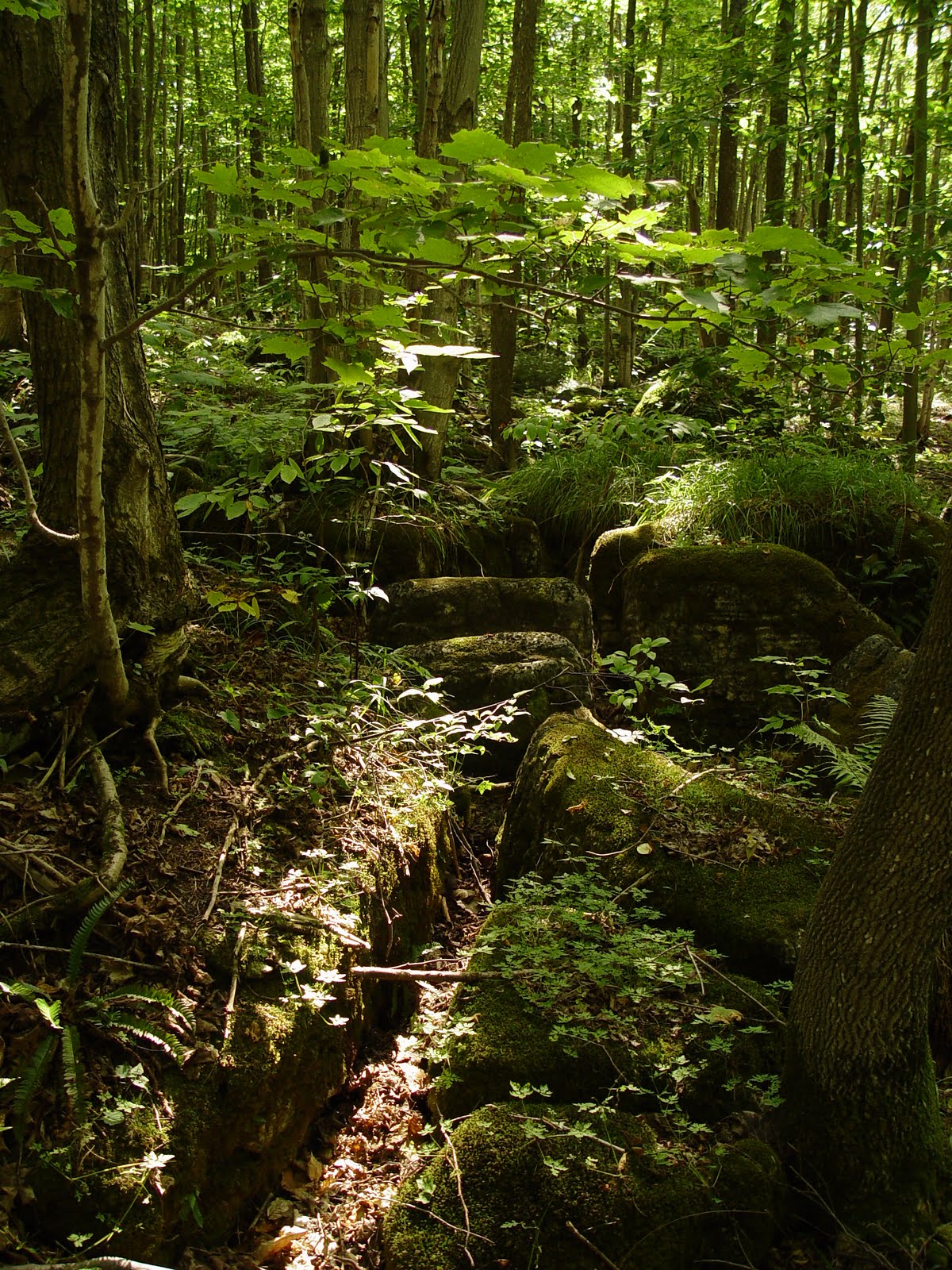
documentary photos of places and spaces, flora and fauna from treks on or near The Bruce Trail and Niagara Escarpment ...

Niagara Escarpment

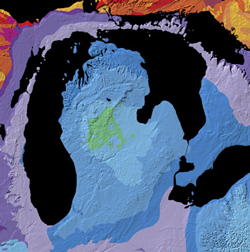
Essentially, the Escarpment is a ridge of rock several hundred metres high in some locations, which forms the outer ring of the Michigan Basin; it was created through a long, complex geological process which includes its having been in the Silurian period, a sea. The Niagara section of this (rough) ring, capped with dolomite, stretches 725 kilometres (450 miles) from Queenston on the Niagara River to Tobermory at the tip of the Bruce Peninsula. Today, in Ontario, the Escarpment contains more than 100 sites of geological significance including some of the best exposures of rocks and fossils of the Silurian and Ordovician Periods (450 to 500 million years old, from the Palaeozoic Era) to be found anywhere in the world.

The rock layers of the Niagara Escarpment date from the upper Ordovician (445 million year ago) to the lower Silurian era (420 million years ago). The rock below, and east of the escarpment is mostly Ordovician limestone. The rock on, and west of the escarpment is mostly Silurian dolostone. Because of this, the escarpment was once called the Silurian Escarpment.


Blog Archive

  • ▼  2011 (1)
    • ▼  February (1)
      • redirect
  • ►  2010 (7)
    • ►  August (4)
    • ►  May (2)
    • ►  March (1)
  • ►  2009 (20)
    • ►  November (2)
    • ►  September (5)
    • ►  August (4)
    • ►  July (1)
    • ►  June (1)
    • ►  May (3)
    • ►  March (1)
    • ►  January (3)
  • ►  2008 (96)
    • ►  December (33)
    • ►  November (63)